Jedediah Island
Friday, June 30, 2006
 We met at St. David’s Church at 6:45 a.m. and carpooled for the 7:20 Langdale ferry. Doris and I had our All-Aboard breakfast with two plates and just had time to eat it and use the washroom before the ferry docked. The journey to Madeira Park was uneventful and we were there an hour earlier than our water taxi would be available. This gave us time for coffee at Java Rocks and a look around the community. I found the regional library in the park near the dock and one of the staff showed me a copy of Jedediah Days. It included a useful trails map but the library had no copier. I copied it roughly by hand and the map turned out to be a useful portable guide through the day. Meanwhile, Bev had gone off separately and came back with a new copy of Jedediah Days which she had bought. At 10:30, the Malaspina Water Taxi returned with two passengers picked up from Nelson Island. He saw them off and then we loaded and were on our way.
Our host gave an interesting commentary along the way; how Irvine’s Pub was closed because of a dispute between the owners; how we were passing between Charles and William Islands; how two islands were Sechelt Nation territory; how one waterless island was the subject of dispute between two divorcing Calgary doctors; how a multi-millionaire’s island had a golf course and heli-pad on the top surface. When we emerged into the main channel the wind was westerly and the water was rough. Even when we rounded the lower end of Texada where the water often becomes calmer, it stayed rough this time. At Jedediah, the tide was very low and since there is no dock, the captain had to search for a spot where he could put us off. He found one to the south of Home Bay where he manoeuvred up against some rocks and we were able to clamber up and reach a grassy slope not far from the homestead settlement. Walking around the edge of Home Bay, which was completely empty of water because of the very low tide, we made our way to what had been Mary and Al Palmer's house. We peered in the windows and enjoyed the orchards before lunching at a pleasant knoll where there was a cooling breeze.
 We then set out to explore the island. The trails map on the notice board had South located at the top of the map, presumably to correspond with the view you have to the south over Home Bay. We managed to identify a small downtrodden area in the grass, heading generally in the north-westerly direction we wanted to go. Following this route, we came to the edge of the meadow and found a wide path through the trees leading in about a kilometre to Deep Bay with Paul Island just offshore. We explored a minor trail to a headland before heading back to the settlement.
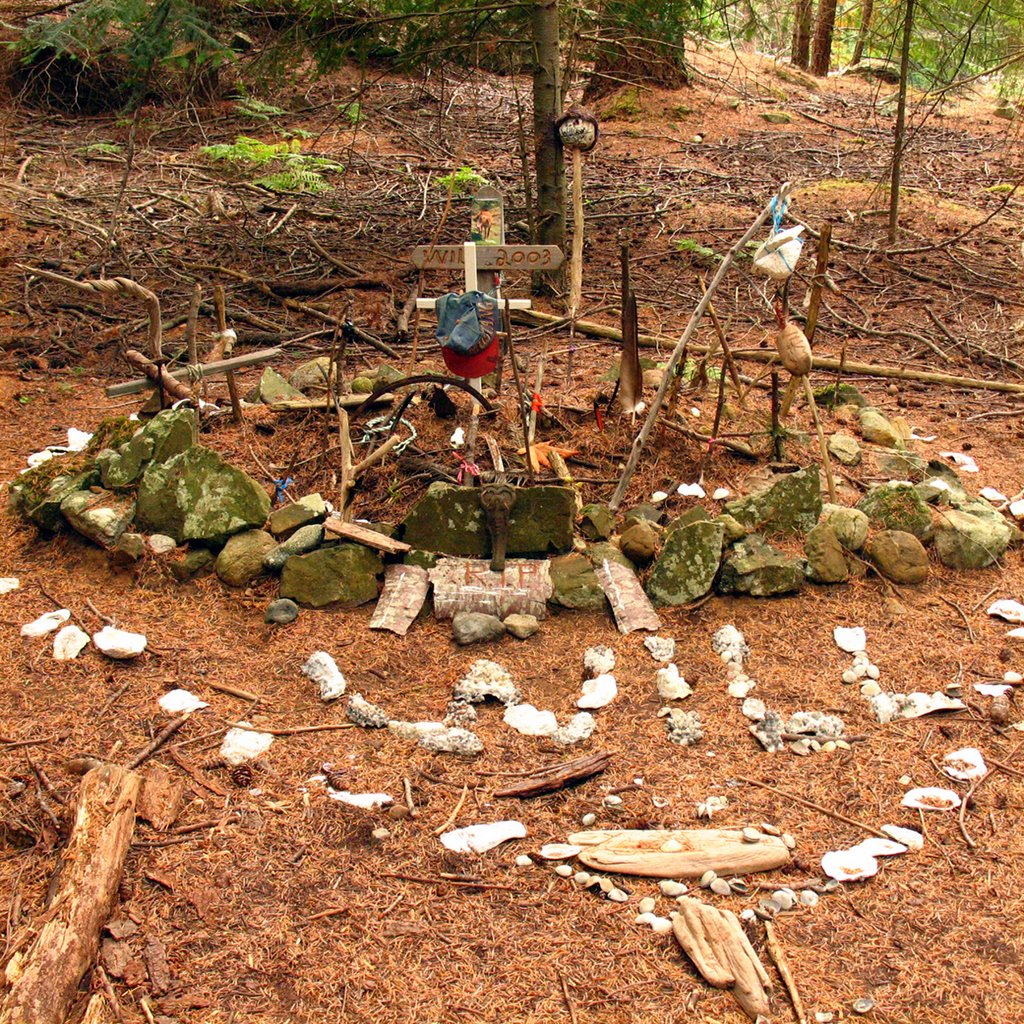
 Our next trip took us west along another downtrodden grass route to reach a wide path leading in about a kilometre to Roger Mattice’s house. Mary had originally settled in Jedediah with her first husband, Ed Mattice and Roger was one of their sons. Roger and his wife Rachel had the house as a summer home for their family and occupied it until 1996. Now it looks like a plywood shell with wiring over the windows and Danger signs instructing you not to enter. We had another refreshment break at a picnic table here and took a look into the two-hole outhouse on the site. We heard some sheep bleating on the hill to the south and thought we could probably see them through the trees. On the way back, we stopped to look at a site decorated with ornaments connected with a favourite horse that the family had owned for years. This was Will's grave.
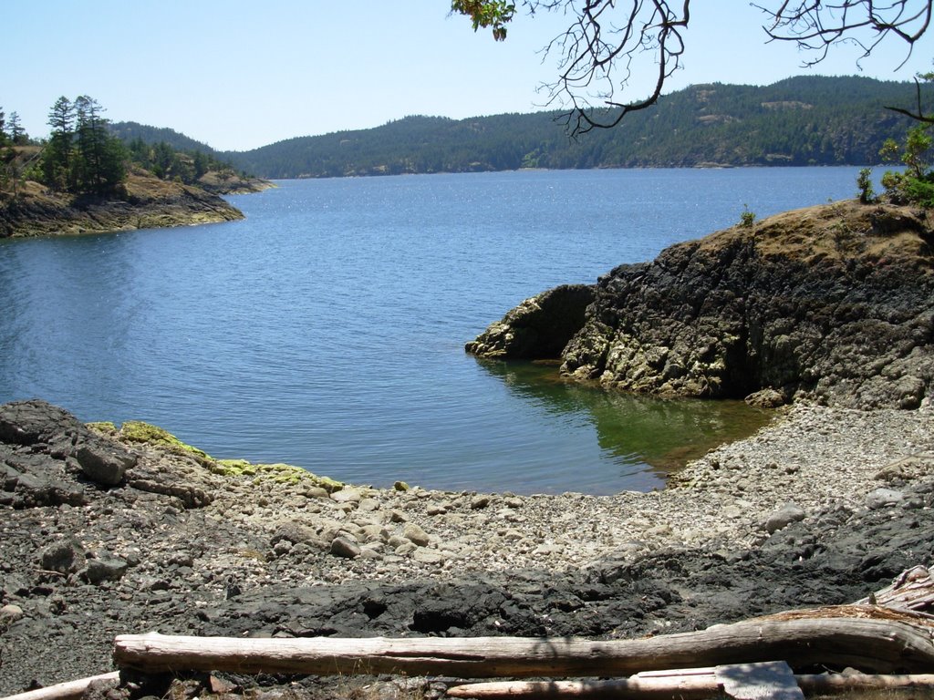
 Retracing our steps to the meadow, we made our final sally to the south to enjoy the view from Codfish Bay. It was another quiet sheltered cove very similar to the other two, and we understood Mary Palmer’s hope that generations would find idyllic refuge in Jedediah. However, it was time to return to our water-taxi which we had left waiting for just over three hours. The captain was waiting and pulled alongside at the same rocks, this time on a higher tide. He told us he had spent time diving to get seaweed out of one engine and thought he had got it all. However, we had not gone far before one engine gave out and we had to make our way back on one engine¾ a two-hour journey instead of one-hour. The water was even rougher than in the morning so the ship did a lot of rolling around. We came in by a shorter route south of Charles Island because of the higher tide, passing a dock with prawn boats berthed, unloading the last catches of the season - only two more days to go.
We left intending to have dinner in Gibsons but thought we might as well go to the ferry first and see if it was still in; if not, we could then turn along Marine Drive to Gibsons Landing. However, the ferry was still in with a man holding the gate open for us. We drove down and loaded on the bottom deck just eight minutes after the scheduled 6:30 departure time.
Malaspina Water Taxi is at 604 740 2486
Return to Further Walks
Archives
![]()